Guide to Durango Mountain Biking: Mid-Country Trails
← return to introduction to Durango mountain biking
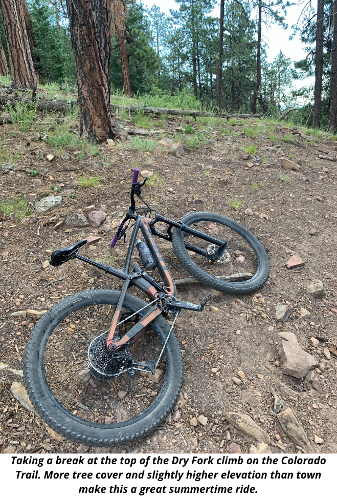
This is one of my favorite trails in Durango! It’s great for riders looking for a full-value ride that won’t take up the whole day or leave you feeling totally exhausted. The Dry Fork trailhead is located at the end of Lightner Creek Road just outside of town to the west. This is a “lollipop loop” that is best ridden clockwise. The climb snakes through the forest at a pleasant grade that makes for efficient climbing without being too tiring. Near the top it enters a band of aspen trees--a sure sign that you’re in the mountains of Colorado! Turn right onto the Colorado Trail and the amazing, long downhill will begin shortly. The top half of this descent features more rocks and technical sections, but none of the drops or obstacles are very large and they can be taken at good speed. Further down the trail starts to get more smooth and flowy, and confident riders can really open up the speed in sections. The final section of downhill is the same as the start of the climb. You can really get going fast here but make sure to beware of riders or hikers coming uphill. A true classic that shouldn’t be missed!
Click here for directions to the Dry Fork trailhead.
Missionary Ridge Trails
There are several great trails that descend from Missionary Ridge, the prominent ridgeline that forms the skyline on the northeast side of Durango. These rides all work best as shuttles, so make sure to coordinate logistics beforehand. Access these trails by driving to the parking area at the end of Sortais Road, then climbing up the double track of FS Road 071, which is closed to vehicle traffic. These trails are not particularly well marked, can become overgrown later in summer, and are prone to fallen logs due to the 2001 Missionary Ridge fire that burned this area. Riding here is a more adventurous experience in comparison to Dry Fork or the town trails, but the descents are of high quality and are fun and challenging for more advanced riders looking for this type of experience.
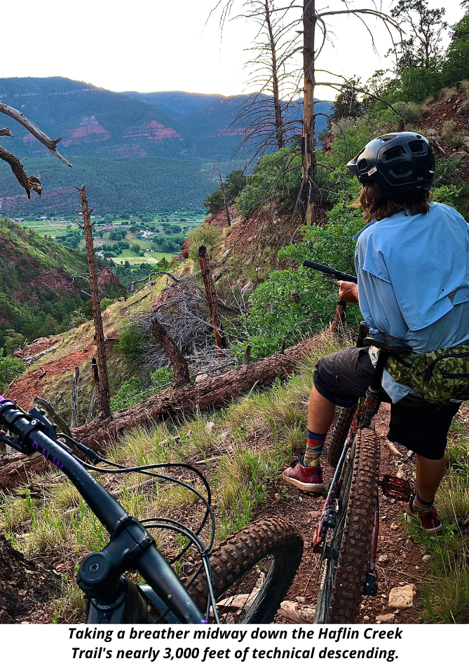
The Haflin Creek Trail descends from just behind the cell phone tower atop Missionary Ridge and drops west off the ridge almost 3,000 feet down to County Road 250 over less than four miles. Tight switchbacks and technical rock obstacles characterize this stellar trail. It begins in a burn zone followed by aspen forest before transitioning into bright red desert dirt and remarkably tacky rock features, making for an amazingly varied ride. There are many sessionable B-lines including log rides, gaps, and drops. It is worth stopping to scout some of the more technical rock sections, since they are often more easily rideable than they first appear. This trail is a must do for riders comfortable trying a double-black level trail!
First Fork descends from Missionary Ridge to the east and brings riders back near Florida Road. It has a similar natural and rugged character to Haflin Creek but is less steep and difficult. The trail descends steeply at first with many switchbacks as well as fast, flowy turns. Eventually it reaches a creek bed and descends at a more leisurely grade along the creek to the end of the trail.
Click here for directions to the Missionary Ridge trailhead.
Log Chutes Downhill
The Log Chutes downhill trail is the only true downhill (no pedaling necessary!), shuttle-accessed trail in the immediate Durango area. Drive up Junction Creek Road past the Colorado Trail parking area until reaching the Log Chutes parking area on the right side of the road just before it switchbacks uphill. Leave a vehicle here for the shuttle, then drive approximately 3.7 miles up the road until reaching a small pullout on the left side at a bend in the road. The fun starts just on the other side of the very small hill next to the road--check your brakes, hold on tight, and let it rip! 1,200 feet of fast descending later you will be back at the parking lot. Run the shuttle and lap it!